Explore Arkansas
Central Arkansas
Little Rock, Conway, Searcy, Benton, Heber Springs
Northwest Arkansas
Fayetteville, Bentonville, Springdale, Fort Smith
South Arkansas
Hot Springs, Pine Bluff, Texarkana, Arkadelphia
Featured Region
See what's happening in Central Arkansas.


Break out those muffin tins because Soup Sunday is back! The...
Explore Arkansas
Central Arkansas
Little Rock, Conway, Searcy, Benton, Heber Springs
Northwest Arkansas
Fayetteville, Bentonville, Springdale, Fort Smith
South Arkansas
Hot Springs, Pine Bluff, Texarkana, Arkadelphia
Featured Region
See what's happening in Central Arkansas.

When Mildred McKnight sat down on the morning of July 23, 1944, to pen a...

Break out those muffin tins because Soup Sunday is back! The...
Featured Topic
Explore the unique food of Arkansas.

Winter in Arkansas calls for warm, comforting drinks, and while coffee...

This is the one time you can have your cake and eat it too—these easy...

Uh oh...
It appears that you're using a severely outdated version of Safari on Windows. Many features won't work correctly, and functionality can't be guaranteed. Please try viewing this website in Edge, Mozilla, Chrome, or another modern browser. Sorry for any inconvenience this may have caused!
Read More about this safari issue.Photo of the Week: Controlled Burn
 View larger
February 16, 2016
Only in Arkansas
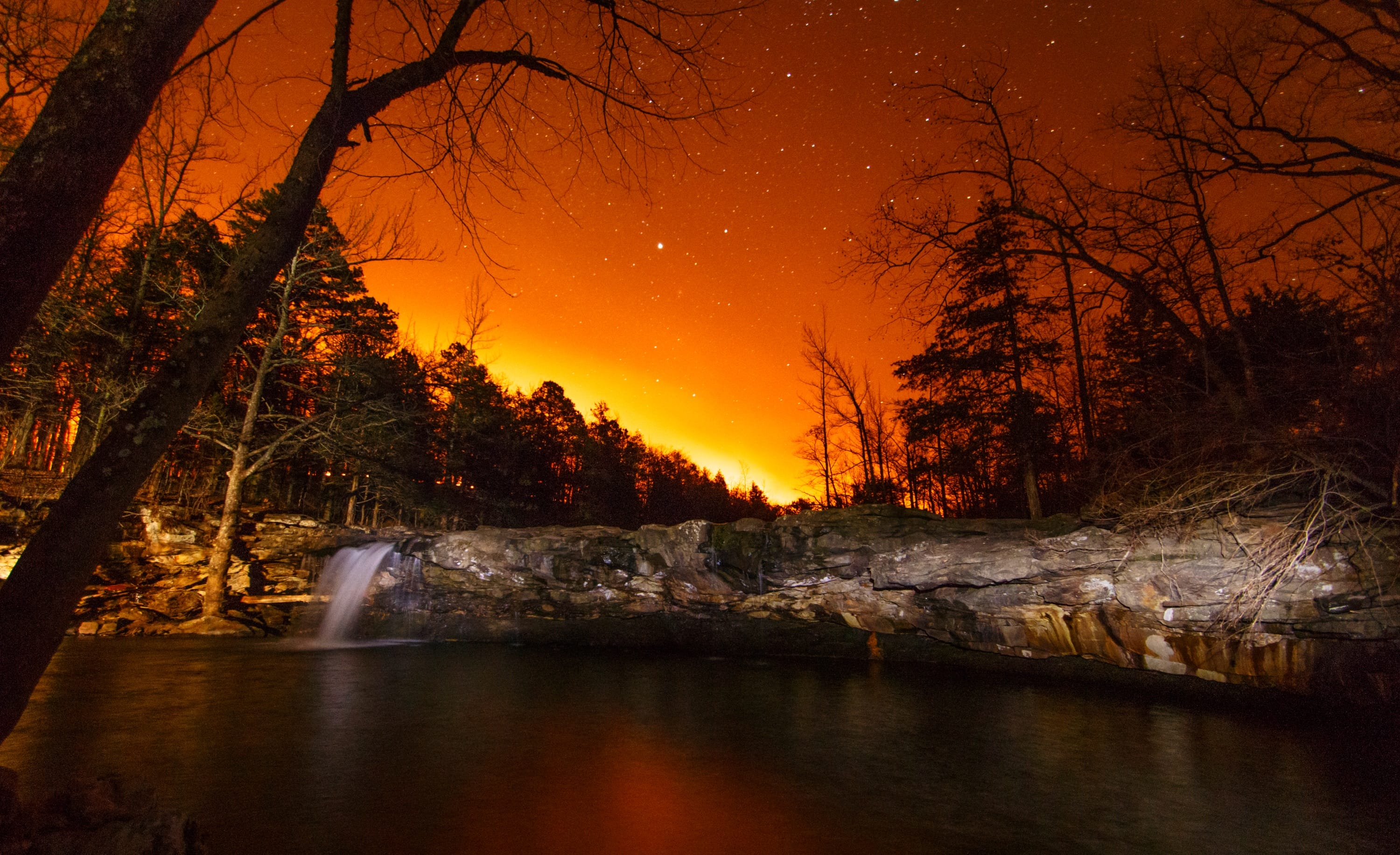
Controlled Burn photo by Eric Treadwell (@geotread)
Richland Creek Wilderness Area is one of the hiking shrines of Arkansas’s Boston Mountains. Almost 12,000 acres in extent, it’s a region of extraordinarily steep and rugged terrain, gigantic boulders, and startling blue green water. But what it’s probably best known for are its fabulous waterfalls. Falling Water Falls, shown in the photo, was captured as Newton County was conducting a controlled burn.
Let’s see what ya got!
Have a beautiful photo you’d like to share?
If you have a share-worthy photo of how you're enjoying Arkansas — from one of our beautiful trails, to a stunning waterfall, or just the ordinary everyday beauty of our state — send it our way!
Submit your photoWe do the work.
You check your email.
Sign up for our weekly e-news.
Get stories sent straight to your inbox!
Searcy, AR 72143fsbank.com877.611.3118Only in Arkansas. First Security Bank, Member FDIC.
Equal Housing Lender | Equal Opportunity Employer © 2025 All rights reserved.
Equal Housing Lender | Equal Opportunity Employer © 2025 All rights reserved.


Join the Conversation