


Uh oh...
It appears that you're using a severely outdated version of Safari on Windows. Many features won't work correctly, and functionality can't be guaranteed. Please try viewing this website in Edge, Mozilla, Chrome, or another modern browser. Sorry for any inconvenience this may have caused!
Read More about this safari issue.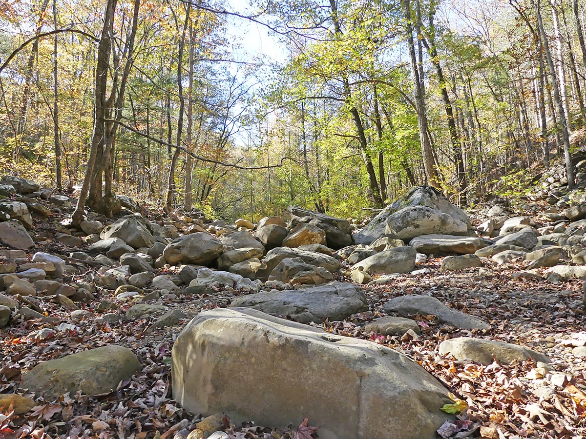

One thing I’ve learned is to never underestimate an Arkansas trail. Arkansas is full of glorious hiking trails, and the thrill of the hunt for a waterfall has led us on many trails this year.
Our latest trek led us on the chase for Thunder Canyon Falls, a waterfall located near the Cecil Cove Loop Trail near the former community of Erbie, Arkansas.
To say I was a bit nervous at the thought of trying to track down this waterfall is probably an understatement. It wasn’t the hike necessarily that made me nervous, though I know parts of the trail can be a bit dicey; it was more the road we had to take to get there.
We’d read so many accounts of how bad the roads are – unmaintained and somewhat dangerous in places. While we’re no strangers to off-road exploring, we searched out the best and safest way to go.
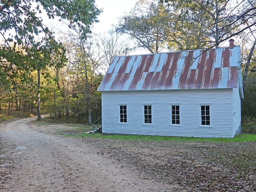
Ultimately, we decided to take the Erbie Cutoff Road, a gravel road that winds past beautiful rolling farmland, through peaceful forest, and over only one low-water crossing. We knew we’d arrived when we saw the old Erbie church on our left and the Cecil Cove trailhead on our right.
Cecil Cove Loop Trail is a 7.4-mile loop trail that features several creek crossings, old homesteads, a cemetery, and of course, Thunder Canyon Falls. We decided to head directly for the falls, which are only about 2 miles, give or take, up the trail.
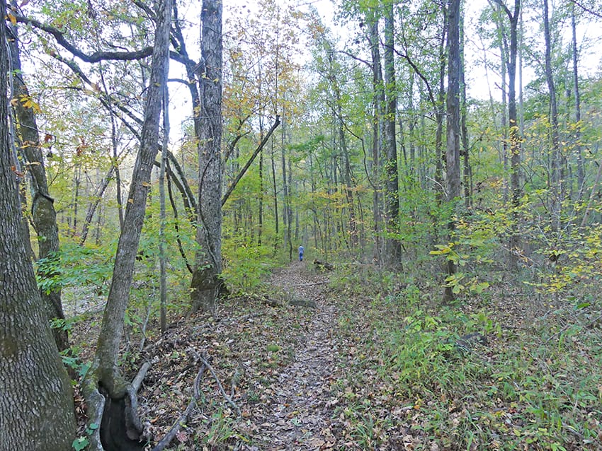
One thing I noticed right away is how peaceful this trail is. It’s pretty lightly trafficked, and with it being autumn, we only ran into 2 or 3 people along the way. The Cecil Cove Loop Trail itself is also rather easy, though parts of it are more moderate with an uphill climb.

We meandered through the trees, crossing the creek in several places. While the creek was dry and there wasn’t a lot of water, I can imagine water shoes might be prudent during the more rainy months of the year… Of course, when the water’s really up, it may be impossible to cross and hike the length of this trail, something to keep in mind if you plan to visit. While you want water so the falls are running, you also want to be safe since there are so many water crossings on this trail.
As we walked, it was so quiet and pleasant, listening to the birds, the bugs, and the wildlife. I’d stop in the middle of a creek bed just to listen and look around. Rock bluffs, sometimes with a cave or two, rose up on one side of the trail, while at one point we hiked along the side of a cliff overlooking the creek bed below. Fall colors made the experience even more spectacular.

Along the way, there were signs of past life, like an old rock wall we suddenly came upon. We also found campsites with the most amazing rock chairs built up around the campfire. We decided this would be the perfect trail for an overnight backpack trip at some point in our future.
And then we went too far and got a bit lost…
Not realizing it, we walked right past the entrance to the somewhat of a bushwhack trail to Thunder Canyon Falls. We wandered on for a little while, eventually growing weary of the search as we realized it was starting to get rather late.
While we didn’t find the falls on this particular trip, thankfully, others have found the falls (while flowing beautifully) and were willing to share pictures from their adventures.
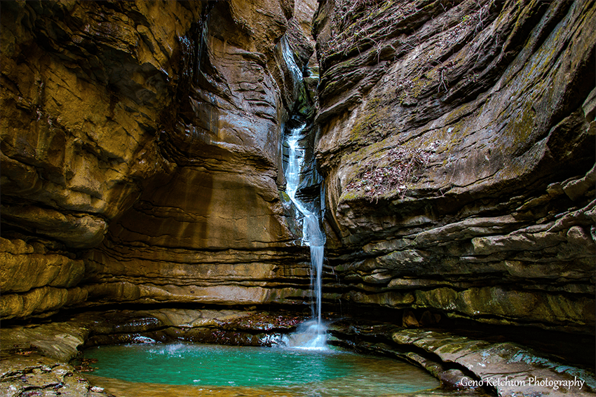
Thank you to Debbie, from Dining with Debbie, for helping me find this photo, used with permission and provided by Geno Ketchum Photography.
Am I sad we didn’t find it? Did it ruin the experience?
Sure, I’m a little sad, but I have no doubt we’ll be back and we’ll find it next time now that we have more of an idea where the falls are. As for our experience, I can’t imagine a more beautiful way to spend an afternoon. The Cecil Cove Loop Trail offers a quiet walk into nature that just can’t be beaten.
Things to Know Before You Go on the Quest to Find Thunder Canyon Falls
- While the loop trail itself is a fairly moderate trail, I’ve read different accounts that the trail to Thunder Canyon Falls can be a bit more difficult and even quite dangerous in certain places. I encourage you to do your research, and always take precautions, especially when hiking with kids.
- You may want a walking stick for certain parts of the trail, especially if bushwhacking.
- Wear pants and wear good shoes. Be prepared to pick burrs off your pants for days, though.
- While there is 1 bathroom at the entrance to the trail, there are no bathrooms along the trail. So it may be wise to carry along toilet paper and even a trash bag.
- Of course, it goes without saying to be sure and carry along plenty of water and food.
- A compass doesn’t hurt either.
Have you found your way to Thunder Canyon Falls yet?

Like this story? Read more from Mel Lockcuff
 3
3
8 Beautiful Gardens in Arkansas

Gardeners unite for the beginning of summer! Arkansas is chock full of...
 7
7
Hike to Glory Hole Waterfall in the Ozark National Forest
Spring is the perfect time to hunt for waterfalls, especially Glory Hole...
 5
5
Arkansas Civil War History – 9 Must-Visit Landmarks
Arkansas is chock full of history, one of the many reasons to love the...
Join the Conversation
Leave a Comment
One response to “The Quest to Find Thunder Canyon Falls”
 Leave a Reply
 Leave a Reply
We do the work.
You check your email.
Sign up for our weekly e-news.
Get stories sent straight to your inbox!

[…] hiking adventures, you know we love the thrill of chasing a waterfall. Sometimes we find them; sometimes we don’t. There have been times where we’ve gone back multiple times to find the elusive big […]