
Uh oh...
It appears that you're using a severely outdated version of Safari on Windows. Many features won't work correctly, and functionality can't be guaranteed. Please try viewing this website in Edge, Mozilla, Chrome, or another modern browser. Sorry for any inconvenience this may have caused!
Read More about this safari issue.

A drive on one of Arkansas’s scenic highways is a great way to appreciate the natural beauty of the state, but the roads we cruise so easily now didn’t always exist. In fact, hardly any roads existed in Arkansas before European settlers arrived, but a few trails provided a way through the swamps and mountains in Arkansas. The Southwest Trail is likely one of the oldest “roads” in the state.
The Southwest Trail became popular when Arkansas began opening for settlement after the Louisiana Purchase in 1803. Before that time, Arkansas was still on the frontier of the country, and not many passed through the state, deterred by its mountains, thick forests and swamps. Still, a trail did exist that began in northern Missouri and cut through the heart of Arkansas before heading south through Hot Springs and then into Louisiana. This trail was called the Natchitoches Trace.
The Natchitoches Trace is named for the Natchitoches, a branch of the Caddo tribe who lived in northeastern Texas and northwestern Louisiana. The Natchitoches Trace ended in modern-day Natchitoches, Louisiana and connected the Red River Basin to the Missouri River Basin. It was likely used as a trade route, and another trail connected the Red River Basin to Tenochtitlan in Mexico. When French and Spanish explorers began to make their way into Arkansas, it is likely they used parts of the trace on their explorations.
The original Natchitoches trail traveled south through the historic communities of Davidson and Litchfield before skirting Searcy and continuing through Little Rock. Then the trail ran to Hot Springs, an area used by Native Americans before it ever grew popular among more recent settlers as a resort. From Hot Springs, one trail led to Natchitoches and another to Fulton, Arkansas and the Red River. As the trace’s use increased among European settlers, the route shifted away from Hot Springs, instead traveling through historical Greenville and Washington before reaching Fulton.

A view of the forest in Historic Washington State Park. Washington was an important stop on the Southwest Trail. Photo: Arkansas Department of Parks, Heritage and Tourism
The Natchitoches Trace also changed from a footpath to one that widened with use to accommodate horses, wagons, and the increasing number of settlers. As travel to Texas grew, the Southwest Trail also became a way for settlers to reach Texas from St. Louis. It should be noted that the Southwest Trail was sometimes a series of footpaths that connected in the same general direction. If a tree or other obstruction blocked the trail, another route might take the traveler off the main trail before eventually connecting back to the route.
Some of the more famous travelers on the trail included Sam Houston, Stephen F. Austin and James Bowie. Another perhaps not-so-famous traveler was a Methodist preacher named William Stevenson. He was a circuit rider who used the Southwest Trail to ride the Hot Springs circuit. Stevenson began riding and preaching around the area in 1816, although he had done so informally since 1813. He was the first circuit rider for the Methodists in Arkansas and rode for 10 years, with much of his time spent on the Southwest Trail.

As the population in Arkansas began to increase, the U.S. government saw the need for a better road through the territory. In the 1830s, parts of the Southwest Trail were encompassed in the Military Road. Other sections remained a trail and simply paralleled the new road. Hot Springs was not included on this road. At the same time, the Memphis to Little Rock Military Road was created. This road also wasn’t part of the Southwest Trail, but it did connect to Little Rock and, by extension, the Southwest Trail. Some of the improvements the government made to these roads included removing stumps and trees, building bridges, and adding ditches to aid in drainage.
Though the military roads helped open Arkansas to settlement, they also served a more tragic purpose when many Native American tribes were forced to leave their land and travel through Arkansas to the newly established Indian Territory. They used parts of the Southwest Trail in their journey.

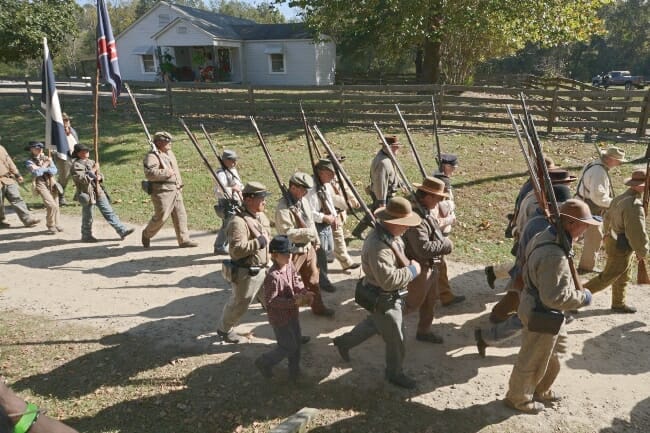
When the Civil War started, the Southwest Trail and the Military Road were used as the primary roadways to transport soldiers and supplies across the state. The northern part of the Southwest Trail had begun to fall into disuse as more people used steamboats and ferries to travel north of the Arkansas River. The southern portion of the trail was still frequently in use, though, and that use continued through the 1800s. The Cairo & Fulton Railroad also planned the first railroad in Arkansas to parallel the Southwest Trail from Missouri to Texas. Though it was delayed by the Civil War, the line was eventually built as the Cairo Arkansas & Texas Railroad (CA&T). The line eventually ran all the way from St. Louis, Missouri to Fulton, Arkansas and was nearly 491 miles long.
Today this railroad route is still in use as the main transport line for petrochemicals out of Texas, and the transport of Arkansas goods to the northeastern U.S. Parts of the Southwest Trail can still be traveled, although it certainly looks nothing like a small path through the woods. Instead, Arkansas highways follow the path of the old trail, including parts of U.S. Route 167, Arkansas highways 124 and 157, and U.S. Route 70.

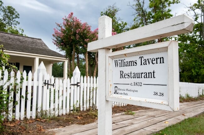
The Southwest Trail is also commemorated at Historic Washington State Park. Washington was an important stop on the trail, and visitors to the area included James Bowie, Davy Crockett, and Sam Houston. Washington was also the capital of the Confederate state of Arkansas, helped in part by its position on the Southwest Trail. The state park has several historic markers and museums detailing the area’s history.

Although much of the original pathway was lost to highways, railroads, and the wilderness when parts of the trail were abandoned, a plan to recreate a portion of the Southwest Trail is in the works. The Southwest Trail System Project proposes a trail from Central High School in Little Rock along the old trail system where the trail was developed into the Rock Island Railroad line that once took visitors to Hot Springs. The rails-trails system would be approximately 65 miles long and connect eight communities, including Benton and Bryant, before ending at Hot Springs National Park.
Although the Southwest Trail is no longer bringing settlers through Arkansas, it survives through the use of highways, rail lines, and trails that still exist to connect the state from Missouri to Texas, and from its past to its future.
To learn more about the Southwest Trail System Project, visit swtrail.transportationplanroom.com and Friends of the Southwest Trail on Facebook.
Join the Conversation
Leave a Comment
2 responses to “The Southwest Trail Through Arkansas”
 Leave a Reply
We do the work.
You check your email.
Sign up for our weekly e-news.
Get stories sent straight to your inbox!


 Leave a Reply
[…] to expanding crop distribution, supplies, and a mail route that replaced much of the traffic on the Old Southwest Trail and the Butterfield Overland […]
[…] reminded of a slower time where lucky days included writing letters to young boys off to war, waiting for a stagecoach to arrive, or buying new fabric for a ballgown and smoking meats for guest soon to come to the village […]