


Uh oh...
It appears that you're using a severely outdated version of Safari on Windows. Many features won't work correctly, and functionality can't be guaranteed. Please try viewing this website in Edge, Mozilla, Chrome, or another modern browser. Sorry for any inconvenience this may have caused!
Read More about this safari issue.

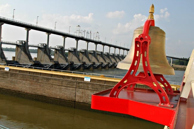
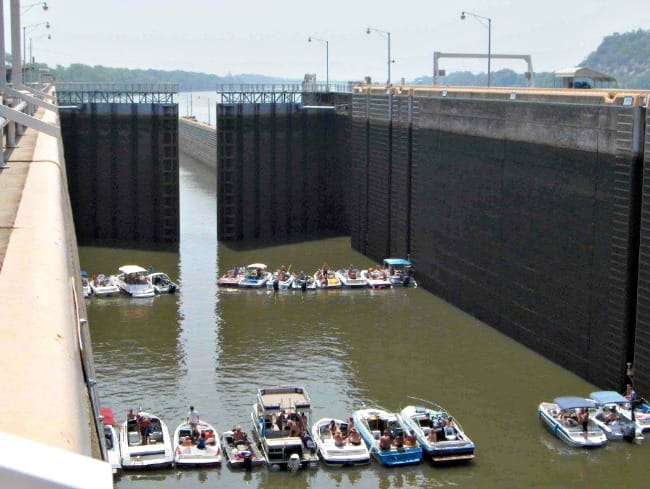
Once on a childhood visit to Little Rock, my family stopped at Murray Lock and Dam. I watched, fascinated, as the water level inside the lock rose and the gates opened to allow the barge to move through.
The Murray Lock and Dam is one of eighteen locks constructed on the Arkansas River as part of the McClellan-Kerr Arkansas River Navigation System. This massive project spanned decades and has impacted Arkansas in many ways.
The Arkansas River crosses the entire state, from its entry point in Ft. Smith to its confluence with the Mississippi River. The river has a long and troubled history with the state’s inhabitants. The French established Arkansas Post, the first trading post in Arkansas, in 1686. The proximity to a Quapaw village and the Arkansas river allowed the French and Spanish traders to trade goods and transport them back to the Mississippi River.
When European settlers began arriving in Arkansas, many towns sprang up near the river, including Little Rock. The Arkansas River provided water and a means of transportation. However, the river is unpredictable. It often flooded in the spring, wiping out crops and even entire towns, like Napoleon, which was once located at the mouth of the Arkansas River. Transportation was also difficult. Late summer and fall often found the river too low to navigate by boat. Steamboats gained popularity in the 1800s, but they couldn’t chug all the way up the Arkansas River due to low water, sand bars and the many twists and turns in the river.
As early as 1832, residents in Arkansas realized the need for a more navigable river. The Corps of Engineers dredged the river to remove the extreme build-up of sand, silt and clay. They also practiced snag removal to keep logs and entire trees from catching ferries and other boats and capsizing them. Despite their efforts, river travel was still nearly impossible from late October to January, and these projects did nothing to protect residents from constant flooding.
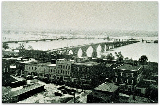
By the next century, flood control became a major issue in Arkansas. The Great Flood of 1927 was the impetus behind a major push for a flood control system. The flood destroyed railroad bridges in Little Rock, broke through a levee at Pine Bluff and inundated millions of acres in the Mississippi River Valley, destroying crops and causing millions in damages.
In 1928, the Flood Control Act defined flooding on the Mississippi River and its tributaries as a national problem, but the Chief of Engineers, Major General E.M. Markham, described the idea of creating a flood control and navigation system on the Arkansas River as “of doubtful feasibility” due to “the considerable slope and the heavy remnant of sand in its bed.” Another flood in 1935 brought together a prominent group of citizens from Ft. Smith, Little Rock and other communities to lobby Congress for river improvements.

The idea of creating a multi-purpose system to provide transportation, hydroelectric power, irrigation and flood control had caught on. Arkansas Governor Ben Laney and Oklahoma Governor Robert S. Kerr both lobbied for a navigable waterway. Although Congress authorized the project, no funds were released.
Kerr was elected to the Senate and Arkansas Senator John L. McClellan joined him in continuing to lobby Congress to fund the Arkansas River Navigation System. Finally, in 1956, nearly thirty years after the 1927 flood brought attention to the problem, Congress passed a Public Works Appropriation that included funds for Dardanelle Lock and Dam, as well as Keystone Dam and Eufaula Reservoir in Oklahoma. It was the beginning of a daunting public works project.
The Corps of Engineers split the project between the Little Rock District and the Tulsa District. The Little Rock District would construct all of the waterways from Ft. Smith to the Mississippi, 67% of the project. Major impediments to construction included the 120 million tons of sediment that built up in the Arkansas River each year. The river also needed to be widened in places, its banks stabilized and have a deeper navigation channel. The Corps spent 20 million dollars alone on dredging 600 million cubic yards of sand from the river.
The Dardanelle Lock and Dam was completed in 1963, forming Dardanelle Lake. Over the next seven years, twelve more locks and dams would be added in Arkansas, while Oklahoma added five of their own. After years of engineering feats like raising existing bridges, moving power lines, dredging, digging a navigation channel nine feet deep, and of course, the locks and dams themselves, the Arkansas River Navigation System was ready.

The project wasn’t without its critics. The railroads opposed the navigation system, saying it was too expensive to build. An article in LIFE Magazine in 1963 called the Arkansas River Navigation Project “the most outrageous pork-barrel project in United States history.” Senator McClellan continued to defend the project and see it through to its completion. On December 31, 1970, the navigation system opened. President Nixon signed a bill naming the new waterway the McClellan-Kerr Arkansas River Navigation System (MKARNS) in honor of the senators who so staunchly supported it. Nixon visited the Port of Catoosa, the terminus in Oklahoma, to dedicate the waterway June 5, 1971.
Forty-six years later, the MKARNS is a busy waterway that transports twelve to fourteen million tons of cargo each year and drawing in two to three billion dollars worth of business. Hydropower plants along the system create clean energy and a series of reservoirs in Oklahoma help keep the Arkansas River from the devastating floods of the past.
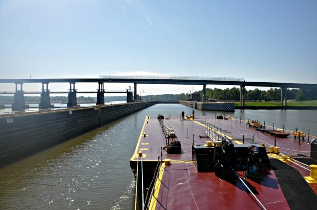
Next time you’re near the Arkansas River or one of its lakes, stop to check out a lock and see how it lifts barges to the next step in the MKARNS. Enjoy fishing or boating in a river now full of water year-round. Or watch for wildlife that inhabit the river and lakes of the McClellan-Kerr Arkansas Navigation System.
The Army Corps of Engineers maintains excellent resources to learn more about the MKARNS and other waterways they regulate. Visit the Little Rock and Tulsa Districts on Facebook for updates on the locks and dams, lakes, flood control and more. Visit their YouTube channels for great videos, including this one for a quick look at how a lock functions on the McClellan-Kerr Navigation System.
MKARNS photos are courtesy of USACE Tulsa and Little Rock Districts.

Like this story? Read more from Kimberly Mitchell
 0
0
Pro Women Athletes from Arkansas Find Success on the Court and the Field | Basketball and Soccer

Women’s professional sports are having their moment. TV coverage and...
 0
0
Three Sisters Springs Healing History
In 1875, a simple homestead became a source of healing, if only according...
 0
0
Stagecoach Robberies in Arkansas
The stagecoach is one of the most iconic representations of the Old West,...
Join the Conversation
Leave a Comment
One response to “The McClellan-Kerr Arkansas River Navigation System”
 Leave a Reply
 Leave a Reply
We do the work.
You check your email.
Sign up for our weekly e-news.
Get stories sent straight to your inbox!

[…] It resumed in 1955 and construction on the Dardanelle Lock and Dam finally began in 1958, but the McClellan-Kerr Arkansas River Navigation System wouldn’t fully open for commercial use until December 30, 1970. The Dardanelle Lock and Dam […]