
Uh oh...
It appears that you're using a severely outdated version of Safari on Windows. Many features won't work correctly, and functionality can't be guaranteed. Please try viewing this website in Edge, Mozilla, Chrome, or another modern browser. Sorry for any inconvenience this may have caused!
Read More about this safari issue.

Many consider the Great River Road National Scenic Byway America’s best-kept secret, but they also say that about the Talimena Byway and even Route 66 sections. But we like to consider the Arkansas portion the biggest kept secret. And, along the route, the towns in the Eastern part of Arkansas are home to beautiful back roads, deep-rooted history and good eatin.’

History of the Great River Road
The Great River Road National Scenic Byway, officially designated in 2002, with the Arkansas portion notated in 2021, follows the path of the Mississippi River through 10 states. This road segment is among the 184 diverse routes across the United States, where the Department of Transportation encourages Americans to get off the interstate and experience the rural and scenic roads across our country. The whole route originates at Lake Itasca, Minnesota, and empties into the Gulf of Mexico south of New Orleans. The northern end of the Arkansas portion begins at the concrete arch, crossing Highway 61 in Blytheville, welcoming visitors into the state.
Many communities along the Great River Road in Arkansas established themselves as crop and cotton headquarters when Mississippi County was the largest cotton-producing county in America from 1932 to 1960. Some considered it the “world leader in rain-grown cotton.” Today, historic sites and museums, downtown squares, and mercantiles continue to give visitors a glimpse of life when dirt streets were host to trading posts and railroad tracks carried cotton by barrels.

Why is the Great River Road in Arkansas important?
The Mississippi River was a critical establishing point for many communities along its path. The significance of steamboats and barges transporting goods and resources from this region to other parts of the nation and overseas built the reliable economy of many of the towns in its path, establishing credibility and necessity for much of the Western United States. Additionally, the Mississippi River was a tourist attraction for the curious and the unique musical styles, new art creations, and architecture brought differentiated cultural experiences for travelers.
Native Americans called the region home, using Crowley’s Ridge for protection, and the dense forests offered easy access to food and vegetation needed to sustain life. Early European settlers entered the continent at Arkansas Post because the Mississippi River brought the most accessible “highway” transportation. In 1815, this area was a launching pad for early explorers investigating the Louisiana Purchase.

The Great River Road also introduces travelers to the unique features of the Delta region, an agricultural landscape greeted by the alluvial floodplains along its banks. This section of Arkansas is home to a wide variety of waterfowl, significant Civil War battle sites, a maritime disaster, blues music musicians, and a unique agricultural landscape that feeds the world.
How do you get to it in Arkansas?
The Great River Road National Scenic Byway begins in Mississippi County and ends in the southern tip of Chicot County. Travelers enter the Arkansas portion of the byway in Blytheville and exit along the Louisiana border in Eudora.

MUST-SEE highlights along the Arkansas Great River Road
- Highway 61 Arch | Blytheville – this wayfinding landmark, built in 1924, is the only arch over a U.S. highway in Arkansas.
- Greyhound Bus station | Blytheville – a historic Art Moderne building from the 1930s, the only one of its kind left in the U.S..
- Blytheville Airforce Base Exhibition – phase one of the National Cold War Center, telling the stories of Eaker Air Force Base and its role in WWII through the Cold War.
- Big Lake | Manila – the 1811-12 New Madrid earthquakes changed this river into a lake. Because of the virgin-cypress swamp, it’s a great place to watch wood ducks year-round with notations from the Wildlife Preservation Society and American Bird Conservancy.
- Mississippi County Museum and Historical Society | Osceola – an official interpretive center of the Great River Road and local history research center.

- Hampson Archeological Museum State Park | Wilson – interprets the lifestyle and village of the Nodena who inhabited the Mississippi River region from AD 1400-1650, including an artifact collection of Dr. James K. Hampson.
- The Louis Hotel | Wilson – a boutique hotel hidden in an agrarian way of life. Do not miss Wilson Cafe or White’s Mercantile when you stop for a visit.
- Sultana Disaster Museum | Marion – called the Titanic of the Mississippi River, a paddlewheel steamboat sunk in 1865 when 3 of its boilers exploded. 1,800 of the 2,300 passengers died. It was considered the “greatest maritime disaster in United States history.” The museum tells the story of this forgotten tragedy and the passengers aboard.
- Big River Crossing | West Memphis – a one-mile pedestrian bridge with the longest active rail/bike/walking bridge in the U.S. and the best-promised river views. This bridge connects riders directly to the Big River Trail system, a 70-mile course atop the river’s levee system.
- Delta Cultural Center, housed in a historic 1912 train depot in downtown Helena, tells the region’s stories from cotton plantations to Civil War participation.
- Helena Museum of Phillips County, or the Storybook of the Delta as some call it, houses exhibit on rail and river transportation, local artists, cultural history and even a heartbroken ghost.
- WG Huxtable Pumping Plant | Marianna – completed in 1977, it is still one of the world’s most significant storm-altering pumping plants, designed to help monitor and regulate the flood plains between the river and St. Francis National Forest.

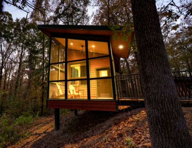
- Mississippi River State Park in Marianna hosts views of the river where the Mississippi River, Crowley’s Ridge and the Arkansas Delta intersect. New camper cabins provide indoor space with bunkhouse vibes.
- Dale Bumpers White River National Wildlife Refuge | St. Charles – home to the nation’s largest contiguous bottomland hardwood forest. It is also home to Arkansas’s only native black bear population and was designated a Wetland of International Importance known for sightings of the Ivory-billed woodpecker.
- St. Charles Museum – holds regional and Civil War artifacts tied to the Confederate troops’ “deadliest shot of the Civil War.”
- Arkansas Post State Park and National Memorial | Gillett – the birthplace of Arkansas where Arkansas’ first explorers arrived in 1686 to establish military and trade headquarters for French, Spanish and the United States.

- WWII Japanese American Internment Museum | McGhee – tells the story of 16,000 Japanese Americans relocated during WWII and the history of those at the Rohwer & Jerome Japanese American Relocation Centers in Desha County.
- John H. Johnson Museum | Arkansas City (Desha County Courthouse Square) – tells the story of the founder of the most prominent African American-owned publishing group, creating Jet and Ebony magazines.
- Lakeport Plantation | Lake Village – an Arkansas heritage site preserving the original plantation site of Joel Johnson and the home later built by his eldest son. The plantation actively manages cotton throughout the year and exhibits tell the story of slavery, racial tension, and cotton.
- Lake Chicot State Park | Lake Village – home to Arkansas’s largest natural lake and North America’s largest oxbow lake, offering fishing, boating and birdwatching.
- Mississippi River Bridge – an architectural work of art connecting Lake Village to Greenville, Mississippi. Two concrete towers stand 425 feet tall with strand steel cables supporting the bridge deck.
- Tommy Marshall Curiosity Center | Eudora – STEM center for elementary-aged children.
Learn More
Learn more about how to explore each town through the Arkansas Delta Byways Tour Guide and the Great River Road attractions list.

Great River Road Turn-by-Turn directions
Great River Road Interpretive Centers
Arkansas Delta Byways information
Other Arkansas scenic byways to explore:
- Arkansas Roadtrips
- Road Trip Games
- Fall Color Road Trips
- Talimena Scenic Byway
- Trucking along I-30
- Sylamore Scenic Byway
- Highway 64
- Ozark Road Trip
- Cave City Road Trip
- 20 Arkansas Restaurants for Quick Day Trips
- A Treasured Road Trip
All images are used with permission from the Arkansas Department of Parks, Heritage and Tourism, unless otherwise noted.
Join the Conversation
Leave a Comment
6 responses to “Get Lost on the Great River Road”
 Leave a Reply
We do the work.
You check your email.
Sign up for our weekly e-news.
Get stories sent straight to your inbox!


 Leave a Reply
[…] taking a day to tour around town, explore the Great River Road – the only All-American road in Arkansas, stretching from Blytheville to Lake Village, […]
[…] Arkansas’s largest natural lake sits in the southeast corner of the state. Lake Chicot is the largest oxbow lake in North America. Its C shape is one mile wide but 21 miles long. The lake offers 5,000 acres, is a refuge for wildlife, and is situated in the Mississippi Flyway, the route many migratory birds take each year when flying south for the winter. Bird watchers and boaters can spot ducks, geese, egrets, ibises and storks. The lake is also the site of Lake Chicot State Park, where visitors can rent cabins, camp, or take a lake tour. Lake Village is on the lake as well and is part of the Great River Road National Scenic Byway. […]
[…] paths we would be driving, so we added an extra day to the front end of our trip to slow down and explore Arkansas’s delta, full of history and delicious […]
[…] grew up in the Delta, near a melting pot of ethnicities, many of whom descended from early immigrants seeking work and […]
[…] At one point, over 500 people worked this land, from cotton fields to sawmills to gins. At the heart of it all was the commissary, a mercantile store that kept everything running smoothly. The original wooden store burned down in 1948 and was replaced by a brick structure. Today, that long brick building with curved roofs still stands proudly beside the Great River Road Scenic Byway. […]
[…] When September arrives in the Arkansas Delta, a quiet transformation begins. The fields that stretch for miles in Mississippi County and beyond start to bloom with white cotton bolls, signaling the start of harvest season in one of the country’s most fertile farming regions. For those who aren’t native to the Delta, it’s an interesting time to see the landscape come alive with a phenomenon unique to this part of the state, marking the connection to the Great River Road. […]