


Uh oh...
It appears that you're using a severely outdated version of Safari on Windows. Many features won't work correctly, and functionality can't be guaranteed. Please try viewing this website in Edge, Mozilla, Chrome, or another modern browser. Sorry for any inconvenience this may have caused!
Read More about this safari issue.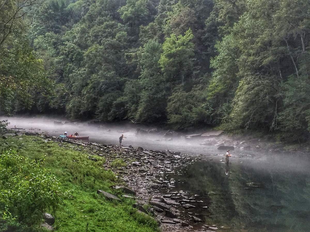

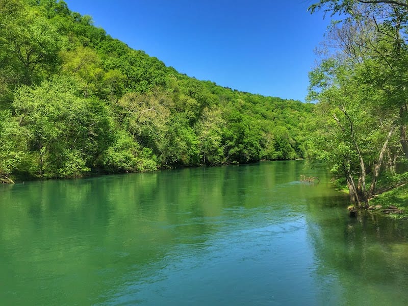
The Little Red River may have once been one of Arkansas’s best-kept secrets, but the word is out, and it’s time to experience all this river has to offer. Although time and technology have altered her path and changed her physical makeup, this 102-mile river and her tributaries provide Central Arkansas with an abundance of tourism opportunities. Clear waters and beautiful views make this world-class trout stream one of the most picturesque rivers in Arkansas.
Ozark Mountains
The Little Red River is fed by tributaries that form in Northern Arkansas in the heart of the Ozark Mountains. South Fork, Middle Fork and Devil’s Fork all converge at Greers Ferry Lake. (The three rivers originally converged just east of Sugar Loaf Mountain.) Since the construction of the Greer’s Ferry Dam, the Little Red River now emerges south of the dam at Heber Springs.
Early Settlers Along the Little Red
Many Native Americans took advantage of all that the Little Red River had to offer. Abundant fish, wildlife and native plants led to several tribes building settlements in the river valley. Evidence of Native American settlements and burial mounds dating back to at least the 1500s have been discovered.
In the late 1800s, Edward Palmer, known for his studies of Indian Burial Mounds all over the South, began studying mounds in the area around the Little Red River. Palmer is also known for investigating Native American burial areas across Arkansas such as the Toltec Indian Mounds, Menard-Hodges, Hughes Mound, Taylor Mound and Tiller Mound.
In the late 1950s, extensive research uncovered many artifacts and several burial grounds throughout the Little Red River Valley. These sites were covered by the lake when the dam was built.

Steamboats and River Transportation
Early settlers also took advantage of the abundant food and water source provided by the Little Red River and the river became an essential resource for transportation. By 1875, steamboats were making their way along the river bringing goods and providing a new means of transportation.
Although steamboats connected early settlers to the rest of the world, some needed to be able to cross the river safely. As early as 1818, there were ferries located along the Little Red, long before the construction of any bridges.
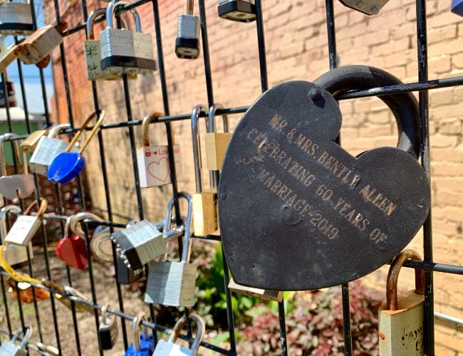
One of the most notable ferries was located along the river at Tumbling Shoals. In the 1880s, William Vincent Greer, also known as “Bud,” moved to the area with his wife. Shortly after his arrival, Greer applied for a permit to operate a ferry at Tumbling Shoals. Greer’s Ferry could accommodate two wagons and teams, and he charged 10 cents for foot passengers, 25 cents for horse and rider, and 40 cents for a wagon and team. Greer operated the ferry until his untimely death in 1890. Greer had fallen off a ladder and broke his neck while attempting to save the family home from a fire. The ferry was so popular that Greer’s wife and daughter continued to operate it following his death until a bridge was built in 1912. The town of Greers Ferry, Greers Ferry Lake, and the dam are all named after William Greer.
Damming the River
Unfortunately, being born in the mountains meant that the Little Red was often subject to intense flooding. Although her waters could be unpredictable, many depended on the river for food and water and travel. Throughout history, the rise and fall of the water caused the loss of farmland and life.
In 1927, the worst flooding in the history of the United States occurred throughout the Mississippi Valley and the southern states. This led to the Flood Control Act of 1938, which included plans for building a dam near Heber Springs. World War II put these plans on hold, but Congress finally approved the dam in 1954. The Greer’s Ferry Dam was completed in 1963 and, in his last public appearance before his death, John F. Kennedy dedicated the dam in memory of William “Bud” Greer and the little boat that once ferried passengers at Tumbling Shoals.
You can learn more about the Greers Ferry Dam here.

The River Proper
The Greers Ferry Dam impedes Greers Ferry Lake and marks the beginning of the river proper. The river meanders for 102 miles until it pours into the White River just outside of Searcy near Georgetown at the Henry Gray/Hurricane Lake Wildlife Management Area.
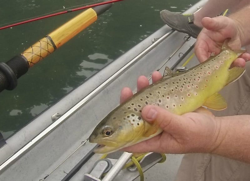
Immediately below the dam, the U.S. Fish and Wildlife Service maintains a trout hatchery. The cold water created by the dam creates a habitat perfect for trout. Natural spawning and regular stocking make the first 31 miles prime trout fishing grounds which rival many of the best streams in America. Rainbow and brown trout are a favorite of anglers, but brook and cutthroats are also plentiful.
As the river winds southeast through White County, her waters give way to several public access areas and popular fishing spots in Pangburn, Searcy and Judsonia. Before emptying into the White River, the Little Red flows through the Bald Knob Refuge and the Henry Gray Hurricane Lake Wildlife Management Area.
Stay Along the Little Red River
Lindsey’s Trout Fishing Resort, Lodge and RV Park
Fish the Little Red River
Beau’s Guide Service
Read more about Beau’s Guide Service here.
Little Red Fly-Fishing Guide Service
Sore Lip‘Em All Guide Service
Read more about owner Jeff Smith, Leland Lures and the Trout Magnet here.
Public Access
Arkansas Game and Fish Commission and U.S. Army Corps of Engineers manage ten public access points along the trout portion of Little Red River just below Greers Ferry Dam. A good map is here.
JFK Park Access (Damsite Catch and Release and Wheelchair Access)
Collins Creek Access (Youth Catch and Release)
Cow Shoals Access (Seasonal Catch and Release and Walk-In Access)
Barnett/Winkley Shoals Access
Libby Shoal (Walk-In Access)
Lobo Access
Dripping Springs Access
Pangburn Shoal Access (Wheelchair Accessible)
Ramsey Access
Monaghan-Womack Access
Other access points are available all along the river and are indicated on this interactive map.
Eat Along the Little Red River

Like this story? Read more from Julie Kohl
 0
0
Guitar Wars Gives Arkansas Amateurs a Stage to Shine

For most people, guitar competitions bring to mind highly trained...
 0
0
More Arkansas Summer Read Alouds
As excited as my son is for the start of summer break, it never takes...
 0
0
Main Street Week in Northeast and North Central Arkansas
The charm of an Arkansas downtown is almost impossible to fake. The old...
Join the Conversation
Leave a Comment
9 responses to “Little Red River in Arkansas”
 Leave a Reply
 Leave a Reply
We do the work.
You check your email.
Sign up for our weekly e-news.
Get stories sent straight to your inbox!

[…] a top trout stream in the country the Little Red is regularly stocked with Rainbow and brown trout. Brown trout are naturally reproducing, and both […]
[…] Little Red River […]
[…] the banks of the Little Red River in north central Arkansas, the tree-lined lakefront property welcomes guests to an outdoor […]
[…] in Heber Springs has been drawing visitors since before the town was formed. The damming of the Little Red River and the subsequent formation of Greers Ferry Lake turned this area in the north central part of the […]
[…] Mountain Ranch – One of two featured courses in Fairfield Bay, Mountain Ranch is highly ranked as the #1 resort golf course in Arkansas and GolfLink’s #4 most valued course in the U.S. It is a challenging course near Greers Ferry Lake and Little Red River. […]
[…] bear the names of their former ferries. Greers Ferry was named for a ferry that operated on the Little Red River. When Greers Ferry Dam was built to control yearly flooding, the name stuck. It now refers to the […]
[…] plenty of options for various types of meat, and a fresh weekend catch straight from the White or Little Red rivers will have anyone licking […]
Judsonia Bridge
This beautiful modern-day scene on Little Red River at Judsonia captures one of the most unique bridges in Arkansas. The cantilevered turn span highway bridge across the river at Judsonia was completed in 1924. It is the only center-bearing swing bridge which survives in the state. The R.L. Gaster Construction Company of Little Rock erected the 2265-foot main span while the residents of Judsonia displayed community spirit in donating time and money to the approaches. The bridge was constructed as part of a national modernizing movement to improve roads, giving the town of Judsonia access to outlying regions on the opposite side of the river. As steamboats came up Little Red River, the bridge’s turn mechanism was operated by one person in the center of the bridge using a key or lever that fit directly into the gars. The peak at the top of the bridge structurally aided in centering the weight over the center pivot and in supporting the ends when the bridge was open. The bridge ceased to turn in the late 1920s as navigation on the river diminished. For additional information, see the 1989 edition of White County Heritage, published by the White County Historical Society, P.O. Box 537, Searcy, AR 72145.
For additional information and pictures see Bridge Hunters Or Arkansas Highway Department
[…] Little Red River – Renowned for trout fishing, offering serene spots for anglers and peaceful riverbank strolls, access points are available at Bluffton Preserve, Archey Fork Park & River Walk and Middle Fork. […]